Sunday, 20 May 2012

Cliffs of Moher

The Cliffs of Moher are a landmark of Ireland's rugged west coast - yet Geoffs only knowledge of them was that they had been used for a Westlife music video! While on the Burran, Karl Hughes had suggested we walk the Cliffs of Moher from Doolin, instead of driving to the usual tourist spot.

Allan had driven through the evening to meet us in Doolin on Monday night as we were finishing up a particularly lively trad (traditional music) session in a nearby pub. Consequently he was rudely rolled out of bed and dressed in time for Karl's arrival.

Karl's local knowledge was invaluable as we worked our way along the cliffs. We found blowholes, sea caves, local swim spots and some fascinating rock formations.

One of the larger sea caves that we saw.  Amazing rock formations on the left.

A steep grassy slope down to the rocks and sea!

Our first viewpoint giving us an amazing view of the Cliffs.  Sea birds swirling above and below us.
Karl also has enormous faith in grass as a climbing aid - quite reminiscent of climbing in the Drakensberg. In order to find some of the most exposed and dramatic view points we had to cut up and down beautifully exposed slopes - Geoff was in his element. Allan feigned being squeamish until we pointed out the sheep wool on nearby thistles showing that a sheep had managed it too!
A VERY steep scramble up from just above the sea with only dodgy grass handholds.  Note the wool on the fence.

The cliffs are incredibly dramatic with layers of black shale and lighter sandstone reaching up to 700ft out of the water.  They are topped by a thin layer of soil with bright green grass and pink flowers while the sea is bright blue below.

Karl's path was at times right on the edge!!!

The cliffs of Moher.

A beautiful lunch spot.

That's flipping high! - Lucy struggled to look.
A huge thank you to Karl for taking the time out to show us his version of the amazing Cliffs of Moher. Having seen the touristy parts there is clearly no comparison and we had a great time.


Gnoming around - Karl and Geoff

Tuesday, 15 May 2012

County Clare

One of our favourite movies of all time is "The Boys and Girl of County Clare" a film about two very competitive brothers whose respective musical groups are trying to win a national ceili music festival contest. The movie is set in County Clare, and features a lot of very good music.

On Sunday morning we headed south around Galway Bay with Allan. We had no real objective other than to be in the town of Doolin by the evening where we were booked into the local hostel, and Lucy wanted to see a lighthouse. As such we simply wandered around the coast.
Unpronouncable street signs
The coastline and mountainous area we drove through is known as the Burren and is geologically famous due to its limestone pavement. We learnt that the barren limestone actually creates a soil condition unique to this part of Ireland which allows a huge diversity of mediterranean and alpine plants and flowers to survive. As such we found a huge variety of beautiful spring flowers including wild roses and orchids. Geoff was more interested in the weird and wonderful rock formations, razor sharp in places, and polished smooth in others.
A lonely lighthouse and a wild sea at Black Head Point.

Rock farming.... yes, those are stone walls dividing the land up.  Not sure those big rocks were planning on escaping though.....!

The limestone pavement is amazing and only when you get up close do you see the wild flowers in between.

We continued on from the coastline to the interior where the landscape continued to amaze us. There are numerous cave systems due to the limestone as well as a fascinating turloughs (lakes) which can appear, and then disappear within a matter of hours due to water tables and rainfall (see http://en.wikipedia.org/wiki/Turlough_(lake)).

We popped in to visit a megalithic site called Poulnabrone portal tomb, a burial ground dating back to 4200BC. It is incredible to think these structures still stand after so many years.
Poulnabrone Portal Tomb

Its pretty big! the roof is over 3 tonnes!

Allan dropped us off in Doolin, and will join up with us later for a few days. In the meantime we have met up with Karl and Kim Hughes. Karl is brother to a work contact of Geoff's and lives in the area. Karl took us for a drive through the Burren via some of his favourite spots, including Kilfenora Cathedral (the smallest in Europe) and an ancient Pagan fertility abbey! We continued then to hike up into the Burren so we could fully appreciate the place. The weather prediction had looked ominous, yet the rain held back until we'd at least finished our lunch before starting to bucket down. Ironically, the gale force wind following the rain dried us within minutes! Karl's knowledge of the local flora was a wonderful resource for Lucy as she quizzed him on almost everything we saw. He also know a few really special spots on the Burren which he took us to.
The pagan fertility symbol above the entrance to the church. Anyone able to see what it is depicting?

Mullagh Mora - we climbed this peak

Geoff and Karl checking out fossils in the limestone

The Burren means 'stoney place' in Irish - they weren't kidding!

Amazing lines in the limestone

Tonight we are heading to a nearby pub to sample the local music for which Doolin is renowned!

Monday, 14 May 2012

Peat

One of the first things that we noticed in the Irish country side (other than stone walls) is the practice of cutting peat.  

I've been trying to do some research on peat and its not easily described, but it is formed by an accumulation of vegetable matter which can't break down completely due to a lack of oxygen (anaerobic conditions).  It is often formed in marshy areas and normally accumulates at an average of 1mm per year.  Under certain conditions, peat is the first step in the process of forming coal.

Out in the rural areas of Ireland, families will each own a piece of bogland from which they cut peat which they use for heating and cooking.  We came across a man working his piece of turf and stopped to chat to him.  He described the process of preparing peat to us. First of all they cut grooves into the field with a blade on the back of a tractor to start draining the peat, these sections resemble huge rubber ribbons.  Walking out to where he was working was a strange feeling as the ground is all spongy and as you walk on it these long ribbons of peat, about 600mm wide, bounce and ripple down their length.  Second the landowner then lifts these 'ribbons', flipping them over and cutting them into 'bricks' about 30cm long and 10cm wide, leaving them to dry out a bit.  They then get stacked into pyramids to dry out properly before being lifted off the ground on pallets to await transport to be stored at the landowner's house.  (I know that this is also done commercially and that the process differs from place to place.)
Drainage grooves cut into the turf.

Wet turf out to dry.

Stacks of turf drying.

Stacking the dry bricks of turf.

Dried peat bricks waiting to be taken home.

Deep grooves where peat has been dug.

The practice of cutting peat and using it as a fuel source has been going on for hundreds of years (if not thousands) and many people rely heavily on the use of peat.  Peat wetlands are an important habitat for many plants and animals and they also act as buffers for flooding and as a carbon sink.

I'm not sure what i think about peat harvesting.  Large areas of the landscape that we have travelled through is scarred by peat harvesting.  In some areas the peat has been harvested down to about 2m.  I know people rely on it for survival, but I can't help wondering if we're going down a road that we really can't turn back on…..

Lucy

The Connemara - land of inlets, lakes and mountains

We're in Ireland!  Land of green and Guinness…


After a week with Geoff in Munich and Lucy staying on at Grendon (in Devon), we met up at Dublin Airport and headed west with Allan Versfeld (one of Geoff's closest friends, living in Dublin) to Galway city where we met up with Deirdre, Allan's (better) half.  
Geoff and Allan

The 4 of us spent a lovely day exploring the Connemara area (counties Galway and Mayo).  The Connamara is a wildish area on the west coast where Irish is predominately spoken (instead of English with an Irish accent - we can't understand, let alone read, Irish).  The coastline is wonderfully rugged with thousands of inlets and rocky outcrops which must make navigation by boat a nightmare!  Really stunning scenery though with little houses scattered around, very furry sheep and cows and of course stone walls everywhere that you look!
Tidal inlets of the coast of Connemara

Stopped for lunch at the beautiful holiday village of Roundstone where there is traditional yacht racing in the summer.  Then winding on along the coast to the town of Clifden - one of the bigger towns in the area.  From there we headed inland into a more mountainous area with many lakes (or loughs), some of which are huge!  We were amazed by the stone walls that seem to run straight up the mountains!  We drove along many beautiful lake and inlet edges with ruined abbeys and little villages, through the area where The Field was filmed and through boggy meadows where peat turf is being cut by locals (more about this in another post).
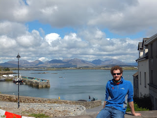
The harbour at Roundstone.  Connemara mountains in the background.

The sea was an amazing colour! (note: sun might be out, but don't be fooled! its FREEZING!)

Geoff, Deirdre and Allan in Clifden

Checking out what dried peat turf looks like.

The peat bog trampoline....

It was lovely to be out in such a beautiful area - quite wild and untamed, and to experience it with good friends!
Spot the stone wall going up the mountain....

Dry stone walls with yellow gorse.

The Connemara National Park.

Sunday, 6 May 2012

Eden Project

We were really keen to visit the Eden Project while down in Cornwall and got there early to make most of it. In brief the Eden Project is an enormous demonstration garden constructed in an old china-clay pit mine. It features two enormous greenhouses one of which houses a rainforest, while the other a Mediterranean biome in which the W.Cape is represented remarkably well. We really enjoyed it, though were disappointed that it provided so little information on the Engineering and Botany of the site and project - which were the things we were most interested in! Read on for a more detailed account...
The Eden Project with its domed greenhouses

Where the Lost Gardens of Heligan were remarkable in recreating a forgotten period in time they had failed to truly allow for a place where people could be amazed by plants and rediscover the incredible connection humans have to nature and in particular its flora, and our dependance on it. The Eden project was launched by the founder members of the Heligan project to address this issue with a particular focus on educating people on where their food comes from. Using their extensive powers of persuasion they convinced a lot of people that this was a great idea and somehow turned a very far fetched concept into reality. The costs of the project, and the sheer audacity of the engineering undertaking are remarkable. And yet Eden remains a viable enterprise and is almost entirely self funded now.
Lucy in the Rainforest Dome

Looking down on the Rainforest from the deck near the top of the dome - those are full on trees down there - we're 40m off the ground!

Mediterranean Biome


Geoff really enjoyed the geodesic dome design of the greenhouses. They effectively created a hexagonal steel frame and inserted inflatable transparent pillows of air between the hexagons to create the roof cover. The greenhouses, or biomes as they are known, are temperature and humidity controlled. The rainforest was sitting at a balmy 29degC with 71% humidity when we left it - we were sweating in our jeans, yet it was a typically miserable 12 degrees outside.
Looking up at the viewing platform with the air vent ("petals") behind  in the roof


A sculpture of seed with Fibonacci sequence - that's 70 tonnes of Cornish Granite right there!
Plantwise we were not disappointed by the scale of the plants and the variety on offer, but felt let down that the signage was so generic and dumbed down. Ideal for little kids and laymen, but Lucy was getting fed-up that she couldn't correctly confirm the ID's of many plants, or their region of origin.

All in all an amazing day visit to see something totally different!!!

Saturday, 5 May 2012

Lost Gardens of Heligan

The Heligan Estate is in Cornwall (SW England) and was the home to the Tremayne family who from the early 1600's developed elaborate gardens.  These gardens ran to ruin after the First World War when virtually all the gardening staff were lost.  By 1990 the whole garden was overgrown with laurel, brambles and other self seeded trees and most of the infrastructure had virtually collapsed and was forgotten.  It was re-discovered by Tim Smit and John Nelson when Tim was exploring the area. Tim and John undertook to restore the gardens to their former splendour, and through a combination of cunning and perseverance succeeded.
The Lost Gardens of Heligan

The garden was spectacular in its day with a huge collection of impressive rhododendrons and tree ferns. They even grew pineapples and grapes in cold England!  They have managed to re-plant many of the old varieties of vegetables and fruit from Pre-1913 including pineapples!  Its pretty amazing to rediscover the Victorian ingenuity and to learn how much they understood about the cycling of materials - We take for granted that back then in their pre-fossil fuel age sustainability as we know it was key to their survival.
Geoff checking out the cold frames and glass house in the Mellon Yard

Lucy listening to the story of the Pineapple Pits. Note round cut edges on glass on glass house and trained apples in the foreground.

Fruit trees trained against walls in the veggie garden

We spent a lovely sunny day at Heligan walking through the walled flower and vegetable gardens, looking at the bee boles (beehives set in a wall where the bees 'nest' in a woven straw basket), and through the spectacular 'feature gardens' like the sundial garden, the scented garden, the italian garden, the Ravine (alpine garden), the North Summer House and Flora's Green with its impressive Rhododendrons and Azaleas.  We also walked through the 'Jungle' which is planted in a valley and has an impressive collection of tree ferns (from New Zealand), redwoods, and massive swamp rhubarb amongst other plants.  
Geoff with a Rhododendron

The Jungle - Indigenous deciduous trees in the background with Rhododendrons from the  East, Tree ferns from New Zealand and other more tropical plants in the foreground.  Amazing!
Some of the most fascinating aspects though were not the organic components, but the man-made structures.  The cold frames and glasshouses with beavertail cut glass to make the water run down the centre of the pane and not the wooden edges and so preventing rot.  The pineapple growing pits with their specialised heating system that required 100 tonnes of manure to fill.  And of course the ram pumping system that they installed to bring water up from the river to fill a reservoir to water the garden and for use in the house.  This system is fascinating as it uses no external power source, just the power of flowing water and can pump up to 100m elevation over 2km!  These pumps were installed over 150 years ago at Heligan and the company that installed them came and helped the restorers uncover the pumps and got them pumping again! Pretty impressive!  More information on the pumping system can be found at http://en.wikipedia.org/wiki/Hydraulic_ram

The Rhododendrons were fantastic!

It is really amazing to see what passionate wealthy gardeners could do back in the day!

Check out more about The Lost Gardens of Heligan on their website at www.heligan.com